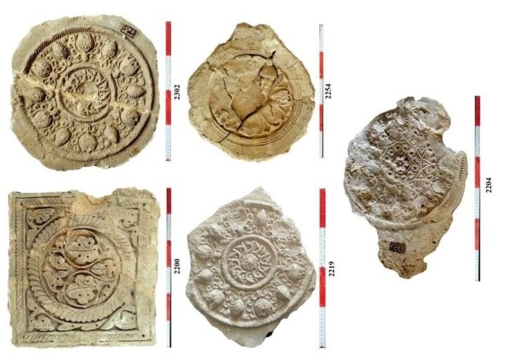
50 historical stucco reliefs of Seymareh to undergo restoration

TEHRAN - The tourism chief of Ilam province has announced a new initiative to document, clean, and reinforce 50 historical stucco reliefs previously discovered in the ancient city of Seymareh, located 100 kilometers south of Ilam.
Farzad Sharifi detailed the scope of the project, which includes creating specialized documentation for each relief and stabilizing the fragile elements to prevent further degradation.
This conservation effort is part of a broader project to preserve and study the artifacts and architectural elements of the largest known ancient city in Ilam province, the official explained.
Elsewhere in his remarks, Sharifi said as part of a comprehensive preservation and registration project, more than 1,000 stucco pieces from Seymareh have been cataloged, with registration documents issued for each item.
The historical city of Seymareh, located on the western side of the present-day Darreh Shahr, spans approximately 70 hectares, making it the largest ancient city within Ilam province.
It was once a summer capital for the Elamites, an ancient civilization active from 2700 to 539 BCE, and later flourished under the Sassanid Empire (224–651 CE). Remnants of its architecture, including sections of walls and arches, remain visible or are buried beneath debris. The site also reveals traces of streets and alleys, showcasing the city’s organized urban layout with its use of stones, gypsum, and lime in construction.
The first archeologist to visit Seymareh was Sir Henry Rawlinson. He began an expedition to the site in 1836. Jaques de Morgan also visited this historical land in 1891 and introduced it as the same ancient city of Madakto. Then it was Aurel Stein who attempted to explore it in 1936, according to Visit Iran, the official travel guide of Iran.
The archeological findings show that the city included about 5,000 houses with some modern aspects, like a water distribution system through clay pipes and underground sewers. The city was destroyed and deserted after a huge earthquake around 950 BC.
The name Elam was given to the region by others–the Akkadians and Sumerians of Mesopotamia–and is thought to be their version of what the Elamites called themselves – Haltami (or Haltamti) – meaning “those of the high country.” Elam, therefore, is usually translated to mean “highlands” or “high country” as it comprised settlements on the Iranian Plateau that stretched from the southern plains to the elevations of the Zagros Mountains.
AM
Leave a Comment